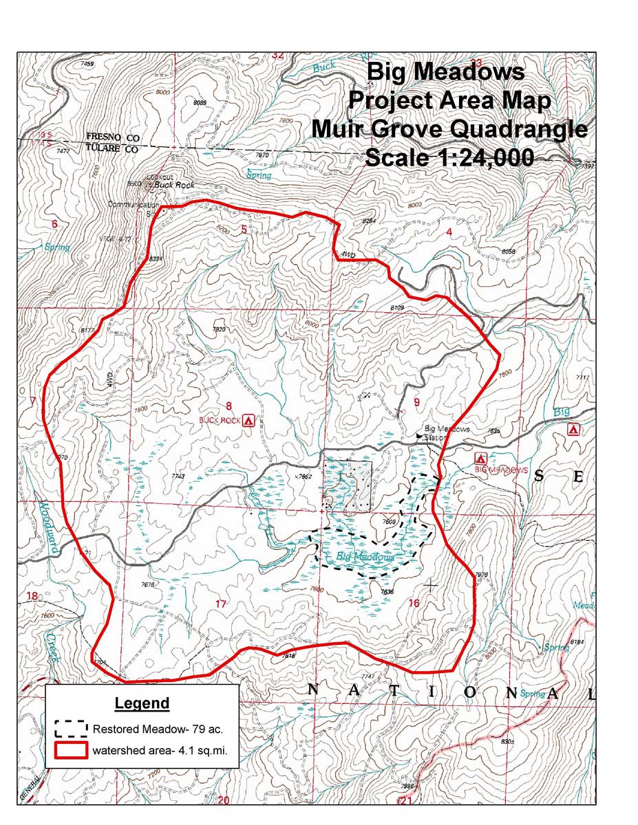
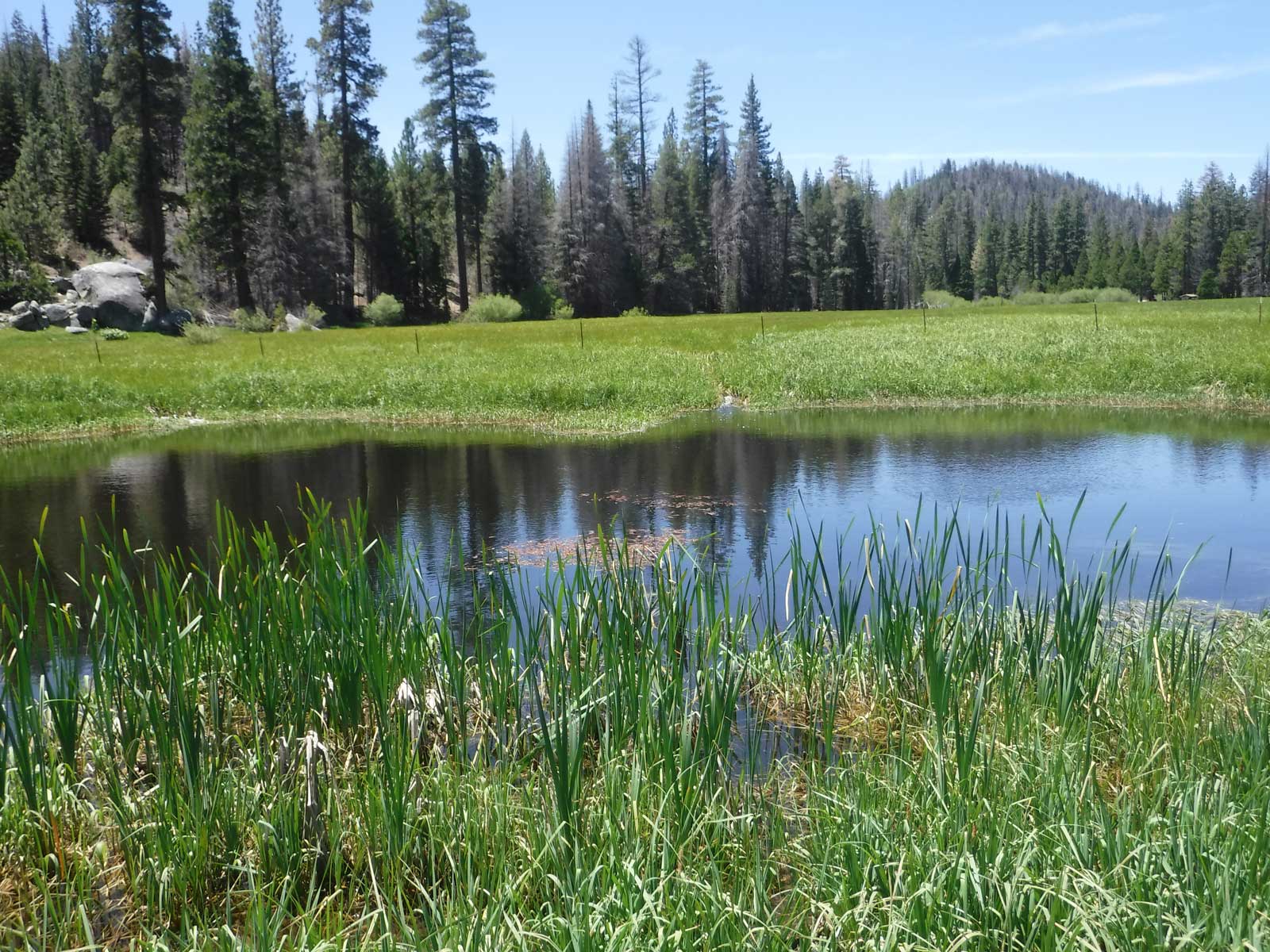
Big Meadows
A collaborative project by Fresno Fly Fishers for Conservation, California State University Fresno, USDA Forest Service, and Plumas Corp.
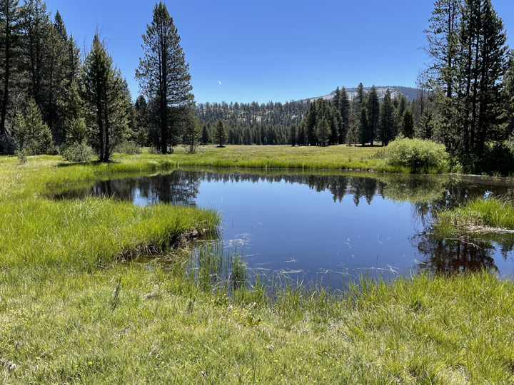
Located in the Sequoia National Forest, Hume Lake Ranger District approximately 56 miles east of Fresno, CA at a mean elevation of 7,600’. Located in the Sequoia National Forest, Hume Lake Ranger District approximately 56 miles east of Fresno, CA at a mean elevation of 7,600 feet, Big Meadows had several reaches of incised stream channels that were effectively draining the meadow and allowing drier site plant species, including lodgepole pine, to establish in what was thought to have been a moist to wet sedge-dominated meadow.
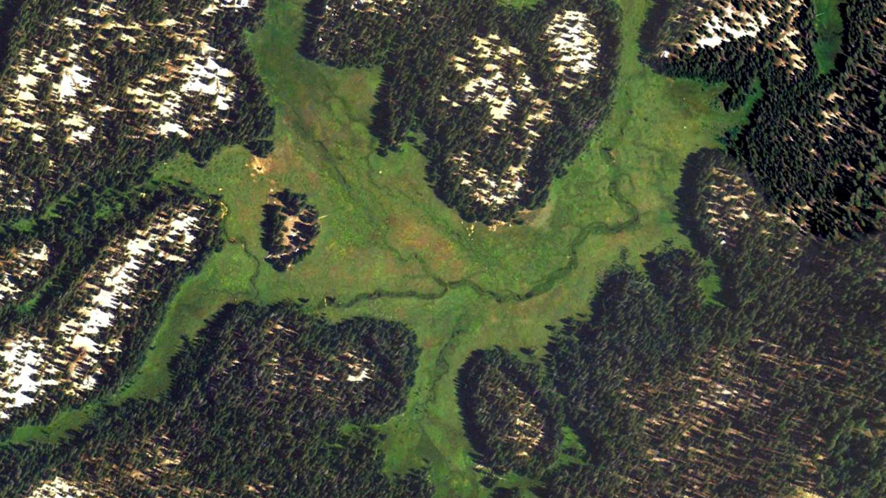
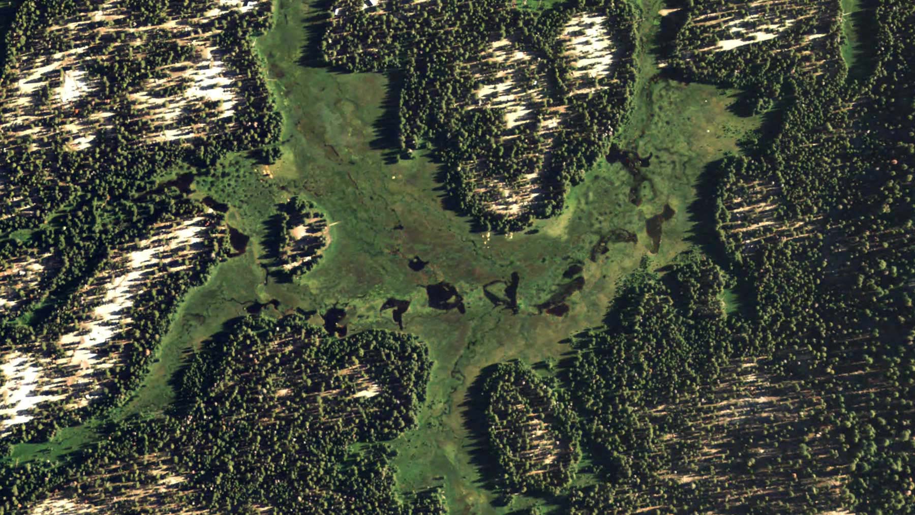
After many decades of incremental check-dam installations intended to raise the stream channel bed and therefore groundwater levels, the Big Meadows team decided to apply a relatively new technique, commonly referred to as “pond and plug”, to improve meadow condition and functionality. The restoration was completed in 2007, and involved creation of 14 borrow pits (ponds) to build 19 plugs in the gullied channel. This forced meadow surface flow to reconnect with nearly 7,000 feet of sinuous remnant channels and enabled annual flooding of 79 acres of meadow.
The specific project goals were to:
- Establish a primary single-thread low flow channel with multiple ancillary channels,
- Reduce flow peaks and increase/extend summer base flows,
- Increase instream cover and shading,
- Enhance aquatic and terrestrial habitat,
- Improve water quality, and
- Raise local groundwater level within the meadow.
Eight years post-restoration, Big Meadows scored the highest CRAM (California Rapid Assessment Method) score yet documented statewide for wet meadows.
Long Meadow
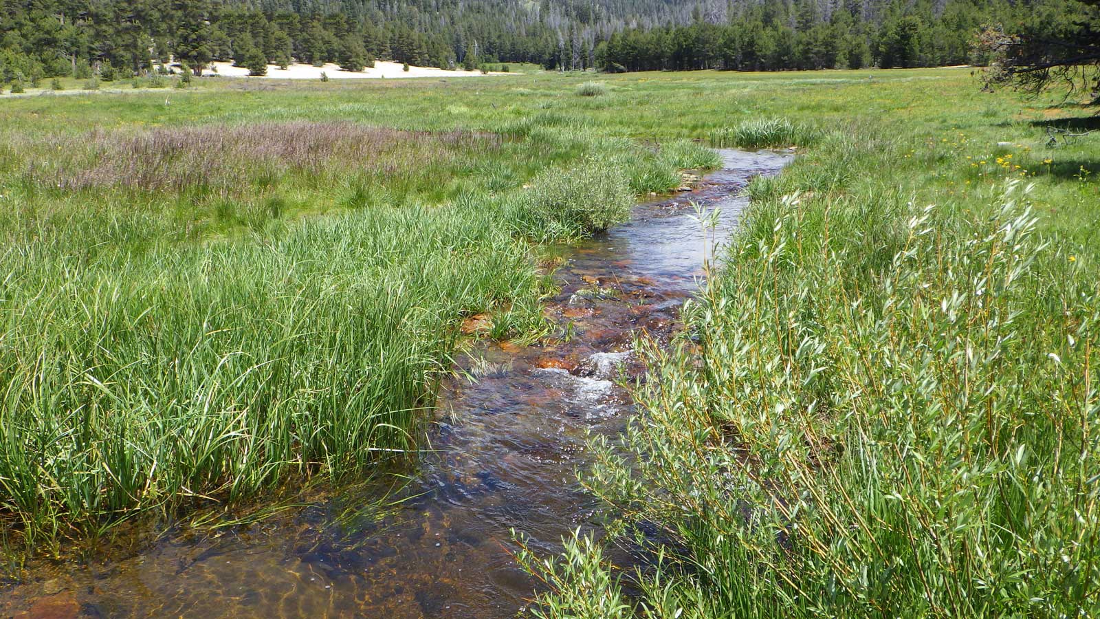
The Long Meadow Restoration Project is located close to the mountain community of Johnsondale, California. The Project is on Long Meadow Creek, which flows into Dry Meadow Creek and into the North Fork Kern River on the Western Divide Ranger District of Giant Sequoia National Monument, and Sequoia National Forest. Long Meadow Creek encompasses approximately 3.5 linear miles of stream before reaching its confluence with Bone Creek.
The focus of the Long Meadow Restoration Project was to regain wetland ecosystem functions that were lost through the effects of legacy grazing, and other unknown legacy land uses in the Kern River watershed. The restoration reconnected about 325 feet of Long Meadow Creek to its meadow floodplain.
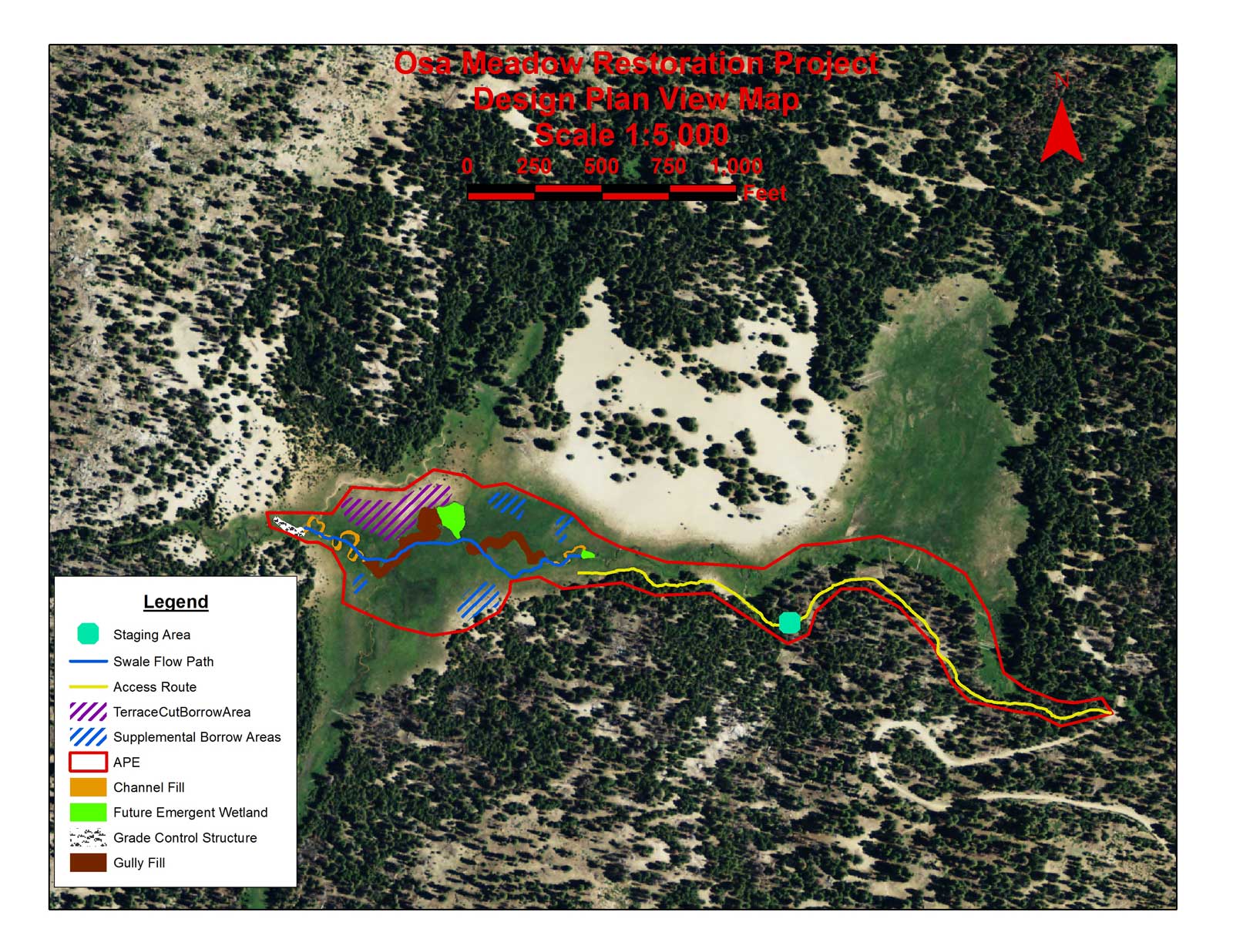
Osa Meadow
The Osa Meadow Restoration Project encompasses 19 acres of meadow in the headwaters of Osa Creek, tributary to North Fork Kern River on lands administered by the USDA Forest Service, Kern River Ranger District, Sequoia National Forest. Osa Meadow was identified as meadow restoration project for a suite of ecosystem benefits, particularly for Kern River Rainbow Trout and carbon sequestration benefits. CalTrout partnered with the Forest and Plumas Corp to restore the meadow in 2016.
Osa Meadows had a large existing incised (downcut) channel as result of over 100 years of land use and natural events. The principal mechanisms that initiated this incision appear to be some channel modifications, past intensive livestock use and road building. This combination of cumulative effects is prevalent throughout the region, and can leave landscapes vulnerable to damage during major floods. Once incision began to change the hydrology, the vigor and resilience of the vegetative community to livestock use was diminished.
Design Concept
The Project restored channel/floodplain connectivity and function to the incised reaches of Osa Meadow. The work was accomplished by near complete fill of the existing incised channel/gully to restore the base level of the channel to the historic meadow elevation. All vegetation and larger woody material (lodgepole pine) from either the borrow areas, plug fill areas or access routes were salvaged. Meadow sod was transplanted into the plug surfaces, with particular emphasis on seams and velocity reduction of overland flows. The lower end of the project was anchored by a Valley Grade Structure. This allowed a seamless transition of the new meadow gradient to the existing channel at the downstream end of the project.