
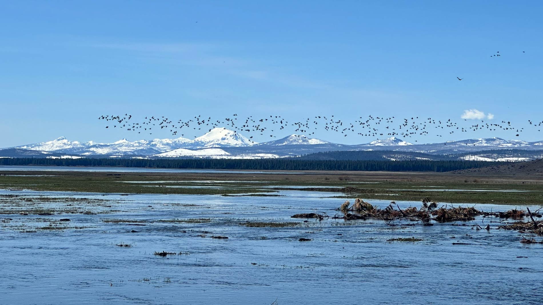
Mountain Meadows Creek is an 8.8 square-mile watershed that is tributary to the North Fork Feather River and is part of a rich ecological complex that supports up to 70% of migrating birds on the Pacific Flyway.
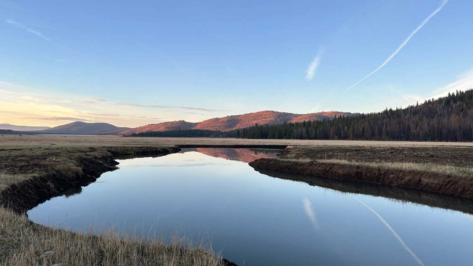
This project reconnected Mountain Meadows Creek with its historic floodplain, restoring the hydrologic function of the meadow. Additionally, the project removed encroaching conifers in the meadow and riparian corridor. In the surrounding watershed, forest health and fuel reduction treatments were designed to reduce the risk of catastrophic fire, increase snow accumulation on the ground, and reduce water loss from canopy interception. The Dixie Fire burned a portion of the watershed surrounding the meadow prior to implementation, and treatments have been revised to encompass salvage, fuel reduction and reforestation efforts.
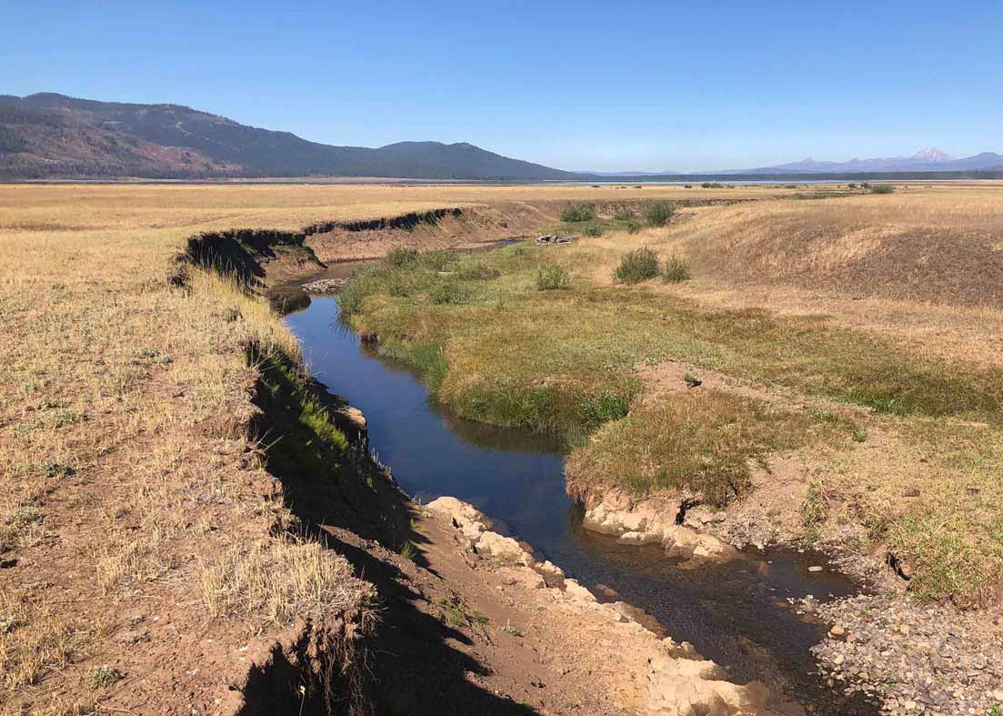
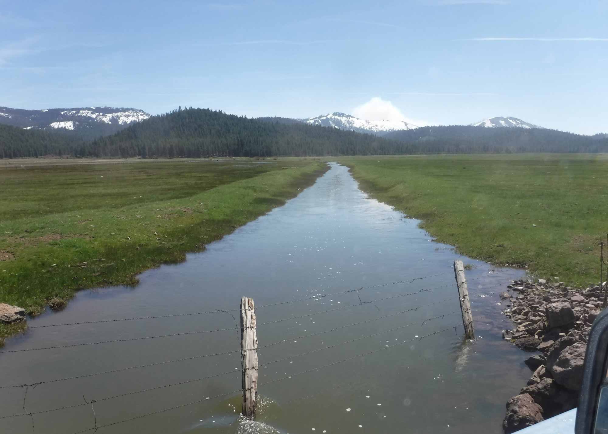
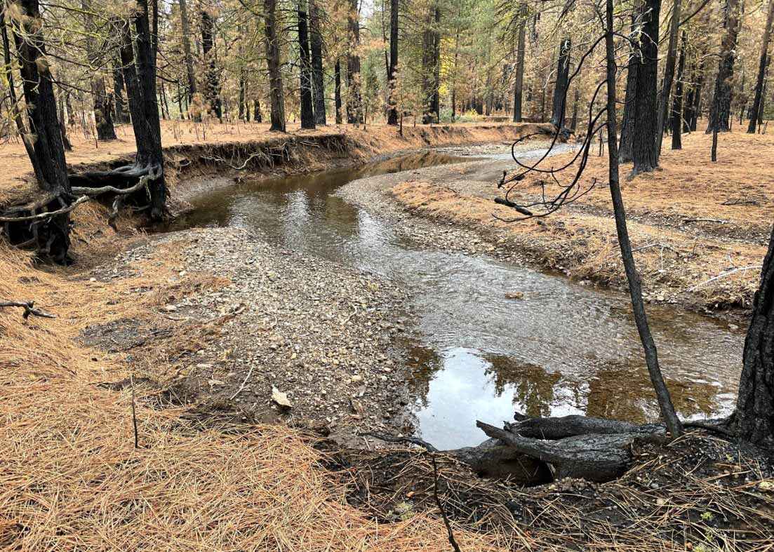
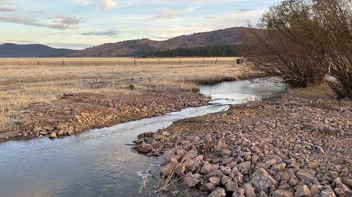
Mountain Meadows Creek has degraded as a result of legacy land use alterations including channel manipulation, ditching, and vehicle use—resulting in erosion and severe channel downcutting (gullying). Gullied channels concentrate flow within the gully walls instead of allowing flows to disperse across the floodplain, leading to a cascade of negative ecosystem effects, including transport of fine sediment from eroding gully walls, reduction in the timing and amount of sustained base flows, lowering of the groundwater table, a shift to upland vegetation and conifer encroachment, and decrease in wetland-dependent wildlife habitat.
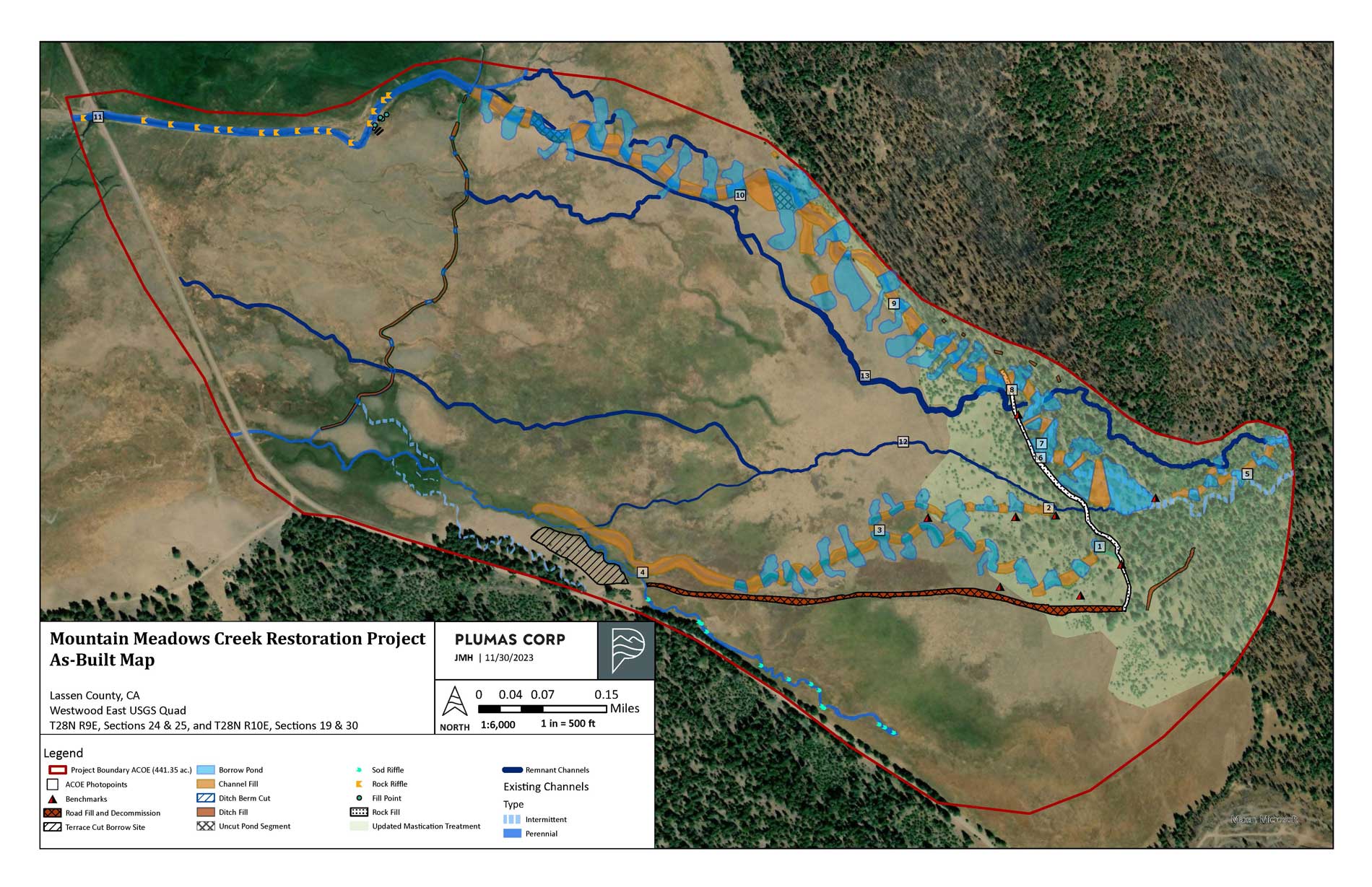
The Mountain Meadows Creek project encompassed a total of 801 acres, consisting of 441 acres hydrologic restoration, 79 acres conifer removal in the meadow and riparian corridor, and 360 acres salvage/fuels reduction for forest health.
Mountain Meadows Basin
The Mountain Meadows Basin is located in the southwest portion of the Southern Oregon-Northeast California (SONEC) region, which supports up to 70% of the Pacific Flyway’s migrating birds. The California Audubon Society has designated the area as a part of the Lake Almanor Important Bird Area, which supports breeding Greater Sandhill Cranes, Eared Grebes, and one of the largest populations of Willow Flycatchers in the State. All of the projects in this meadow complex have incredible habitat value. Mountain Meadows is also an important part of the home range of the Lassen Pack of gray wolves.
This area is a focus of a region-wide restoration effort on private lands. Plumas Corp is actively involved in 2,400 acres of meadow restoration in various phases, including Upper Goodrich Meadow, Greenville Creek, McKenzie Meadows, East Creek, Mountain Meadows Creek, & Lower Goodrich Creek.
Pre-Project Conditions
Legacy impacts affected the path and velocity of surface flows, initiating channel incision. Additionally, while grazing can be a compatible use with meadows, in a degraded state it can exacerbate ongoing erosion. At Mountain Meadows, Creek , the net impact was a dramatic realignment of the channel and incisionand to more than 17 ft at the time of construction. The incision had left the meadow disconnected from its floodplain, with the end result of valuable meadow habitat replaced by xeric grassland on a large scale.
Hydrologic Restoration
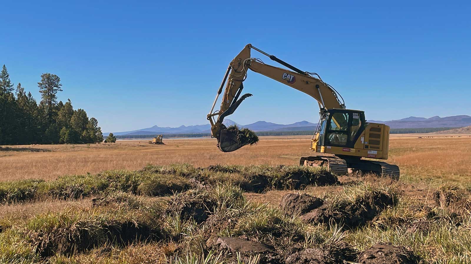
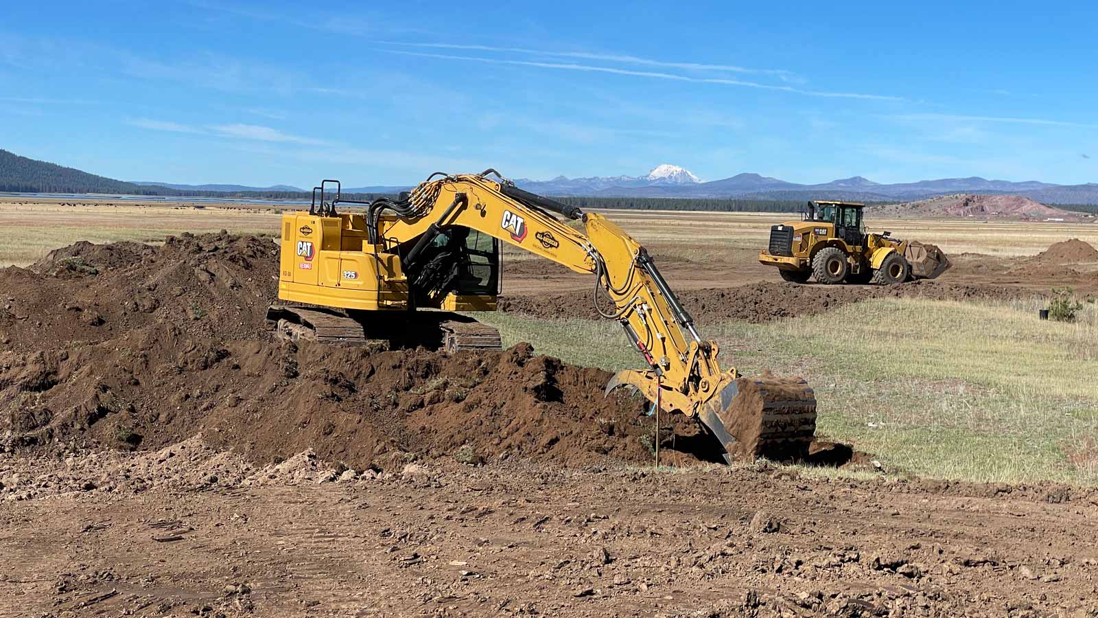
Plumas Corp restored the hydrologic function of the channel/floodplain, through partial fill of the active incised channel, the two abandoned incised channels, and inset road segments. In addition, portions of the active incised channels underwent riffle augmentation treatment (both rock and sod riffles) to achieve restored base level goals.
Gully fill provided native material to disperse flow from the main channel into a remnant channel network at two key locations. The fill areas and borrow ponds were sited and configured to accommodate surface and subsurface throughflow as well as adjacent hillslope-generated surface and groundwater inflows. This reduces the risk of re-incision through either fill or native soil during infrequent, short duration flood events. The downstream edges of the fill are also heavily planted with sedge mats recovered from the gully bottom prior to filling. Material was excavated from 53 borrow ponds and an area of terrace cut. Topsoil was removed and stockpiled while native sedges and grasses were saved and re-planted on the surface of newly constructed fills.
The fills were constructed with wheel loader(s) to provide compaction of the fill material. The compaction levels are intended to match the porosity/transmissivity of the native meadow. This allowed moisture to move freely within the fill soil profile and support erosion resistant meadow vegetation for long term durability as well as preventing preferential pathways for subsurface flows either in the fill or the native material.
Riffle augmentation was used in both the main channel at the bottom (northwest) end of the project area and in a swale along the southern edge of the meadow. Riffles were used to raise the base level of the channels in their existing alignment. Riffle material was comprised of locally sourced rock/soil mix and on-site meadow sod.
- 445,000 yd3 gully void – approximately 223,000 yd3 fill
- Created of 21 acres of ponds
- 1.8 miles incised stream channel eliminated
- 2.7 miles reactivated stream channels
- 16 rock riffles – habitat creation in dredged main channel
- 13 sod riffles – treat incision in south swale and improve riffle-pool habitat
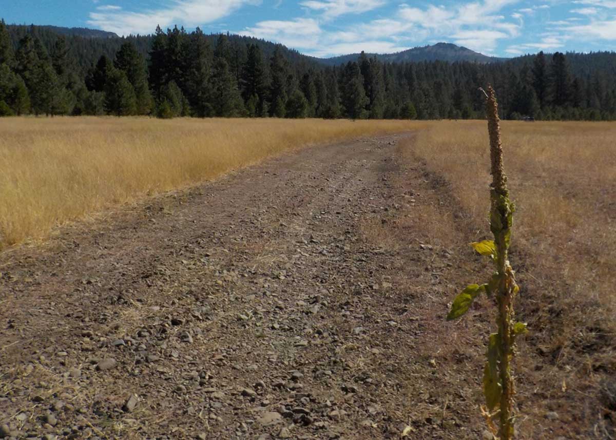
- Removed 3,000 ft of cross-meadow road
- Conifer removal in 69 acres of meadow and riparian corridor
- 95 acres – estimated wetland expansion
- 120 acres – estimated transition of grassland to mountain meadow
Forest Recovery & Fuel Reduction
Through discussions and site visits with WM Beaty & Associates and Plumas County Fire Safe Council Staff, Plumas Corporation expanded the scope of the meadow restoration to include forest health and hazardous fuel reduction treatments in the forest adjoining the meadow and in the upstream riparian corridor. The adjacent forest was characterized by an unhealthy forest structure with an accumulation of ladder vegetation and ground fuels, which increases the risk of catastrophic fire, forest mortality, and fire-related water quality impacts. Along the remnant channel and forested floodplain, relict patches of gallery riparian forest were present, including mature black cottonwood, alder, and willow. Regeneration has been limited by substantial conifer encroachment across the floodplain. WM Beaty & Associates developed the design and treatments for the surrounding forest and upper riparian corridor, and Plumas Corporation removed conifers on the middle and lower reaches. The project revegetation plan includes planting cottonwoods and riparian shrubs throughout the the riparian corridor.
Revegetation & Seeding
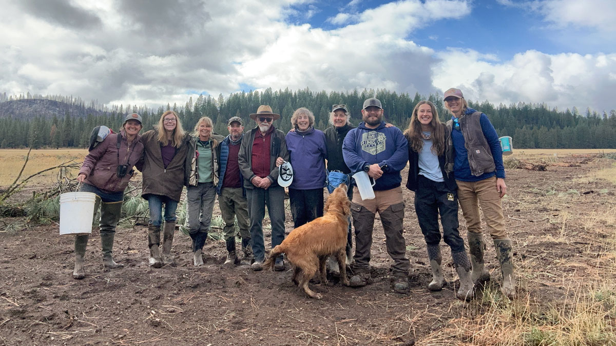
Phase 1 of the revegetation plan was implemented immediately following construction. An awesome team of volunteers spread native seed on all disturbed areas within the project. In total, volunteers covered approximately 15 acres, using a total of 100 lbs of “dry” seed blend, suitable for intermediate meadow habitat, and 70 lbs of “wet” seed blend, for areas that will be inundated for several months of the growing season. Approximately 40 bags of Deschampsia (slender hair grass) seed and straw were spread on-site, as well. This seed/straw blend was locally sourced from lands owned by the Collins Pine Company, which purchased tracts that include several earlier Plumas Corp restoration projects.
Upcoming Project Activities
- Continued monitoring
- Monthly groundwater levels (4 wells)
- Continuous groundwater levels (2 wells)
- Water temperature monitoring (seasonal)
- Avian surveys (2025)
- Carbon sampling (2026)
- Planting riparian shrubs & willow staking
- Fencing & grazing management
- Drone imagery
Project Partners
- WM Beaty & Associates
- Point Blue
- California Department of Water Resources
Supporters & Volunteers
- Mountain Meadows Conservancy
- Friends of Mountain Meadows
Funding
- National Fish & Wildlife Foundation
- Wildlife Conservation Board
- Sierra Meadows Partnership Block Grant (WCB/Point Blue)
- Bonneville Environmental Foundation (BWS/P&G)
- Red River Forests Westwood LLC